Annual Conference
Dive Into Discovery
GANJ Annual Conference 2024
Advances in Applied Hydrogeology of the Newark Basin: Evolving Conceptual Site Models, Characterization Techniques & Remediation to Meet 21st-Century Challenges.
GANJ 2024 will bring together a special combination of research and consulting industry professionals (including several whose work is integral to the NJDEP groundwater guidance) for a 2-day exploration of current and emerging trends in the applied hydrogeology of the Newark Basin. The event will take place at the Stony Brook‐Millstone Watershed Institute, in Pennington, Mercer County, NJ. Day 1 will consist of 9 lectures spanning subject matter ranging from fundamental scientific principles critical to CSM development; evolving CSMs and investigative practices; evaluation of the “weathered bedrock” zone; and remediation case studies, including one dealing with PFAS. Activities on Day 2 will include hydrogeologic field demonstrations at a radial wellfield in the Passaic Formation, installed on the site in the 1960s to support research by USGS to aid understanding of the apparent strike-parallel anisotropy of rocks then referred to as the Brunswick Formation. We expect this will be an excellent learning event for people from a wide range of backgrounds there will be ample opportunity throughout both days for interactions with presenters.
Agenda
October 18, 2024: 8:00 AM – 5:40 PM
Day 1 – Platform Presentations
Location – The Watershed Institute,
31 Titus Mill Rd., Pennington, NJ 08534
Registration – Breakfast
Opening Remarks – Jim Peterson, PG, LSRP
Session 1 – Keynote: Jessica R. Meyer, PhD – Using Existing DNAPL Contamination as a Tracer to Elucidate Aquitard Characteristics in a Layered Sandstone Aquifer System
Session 2 – Andrew Michalski, PhD, PG – Choice of Conceptual Groundwater Flow Model as a Critical Issue for Characterization and Remediation of Contaminated Bedrock Sites in the Newark Basin
Session 3 – Pierre Lacombe – Hydrogeologic Framework at a Contamination Site based on Geologic, Offloading, and Weathering Strata Augmented with Water-quality and Water-level Data and Concepts
Break – (15 min)
Session 4 – Thomas D. Gillespie, PG – Hydrostructural Geology: Examining the Anisotropy Assumption for Solute Distribution in Bedrock Aquifers
Session 5 – Gregory C. Herman, PhD – NJGS Bulletin 77 Summary of Fractured-Bedrock Aquifer Borehole Research in the Eastern Half of the Newark basin
Lunch – (1 hour)
Session 6 – Rich Britton, PG, LSRP – Utility of the LMAS Model to Resolve Responsibility for Off-Site Groundwater Contamination in Bedrock
Session 7 – Paul Trudell – Vertical Delineation of the Weathered Bedrock Geological and Hydrogeological Unit in Central New Jersey
Break – (15 min)
Session 8 – Bob Bond, PG – Application of Environmental Sequence Stratigraphy to Sedimentary Bedrock Aquifers with Commingled and Co-located VOC and PFAS Plumes
Session 9 – Grace Chen, PE – Remediating Contaminated Bedrock Aquifer using In Situ Bioremediation Technology
Closing Thoughts – Jim Peterson, PG, LSRP
Business Meeting – Moderator, Jim Peterson, PG, LSRP
October 19, 2024: 8:30 AM – 5:00 PM
Day 2 – Field Demonstrations
Location – The Watershed Institute, Pond House, 261 Wargo Rd., Pennington, NJ 08534
Registration – Welcome
Field Demonstrations – Concurrent Sessions 1-5
Breakout Session 1 Timothy Hull, PG, LSRP – Multi-parameter Geophysical Logging
Breakout Session 2 Lee Slater, PhD – Cross-Borehole Electrical Resistivity Tomography Survey
Breakout Session 3 Pierre LaCombe & Alex Fiore, PhD – USGS Naval Air Warfare Center Fractured Bedrock Research Findings and Rock Core Review
Breakout Session 4 Valerie Holliday, PG – Review of Core and Geophysical Logs from a Central NJ DNAPL Site
Breakout Session 5 Sean Kinney, PhD – Review of ongoing Research by Rutgers / LDOE Geological Core Laboratory Repository Scientists
Lunch
Field Demonstrations – Concurrent Sessions 6-8
Breakout Session 6 Jim Peterson, PG, LSRP – Correlation of Geophysical Logs – A Crucial and Underutilized Geological Skill
Breakout Session 7 John Dougherty – 3-D Visualization of Hydrogeologic Models using Leapfrog
Breakout Session 8 Andrew Michalski PhD, PG & Tim Hull, PG LSRP – Pumping-stressed Hydraulic Monitoring (well interference) and Single Packer Hydraulic Monitoring
Take-Home Messages & Conclusion – Panel Discussion, Q&A
Session Descriptions
Jessica R. Meyer, PhD
Dense non-aqueous phase liquid (DNAPL) contaminants in fractured bedrock aquifers are complex hydrogeological systems to characterize, particularly after several decades of evolution due to dissolution, diffusion, and degradation. At a site in southern Wisconsin, a multicomponent DNAPL migrated through glacial sediments and sedimentary bedrock ultimately accumulating between 45 and 55 m below ground surface (bgs) in a fractured sandstone. Previous investigations noted there was not an obvious aquitard beneath the accumulated DNAPL leaving an important gap in the conceptual site model (CSM). The objective of this study was to improve the delineation and characterization of aquitard units at the field site to answer two key questions: (1) what aquitard characteristics contributed to stopping downward DNAPL migration and (2) do these same aquitard characteristics occur at other positions between the DNAPL and the underlying regional aquifer. Aquitards were identified and characterized using a diverse set of high-resolution data sets. Here, an aquitard was defined as an interval of rock that produces a distinct increase in the vertical component of hydraulic gradient in a high-resolution (3 zones/10 m) head profile. The aquitards were then described within a sequence stratigraphic framework based on detailed sedimentological logs from core and natural gamma logs collected in the boreholes. Fracture network characteristics and connectivity were assessed using cores, borehole image logs, and outcrop observations. Estimates of bulk vertical hydraulic conductivity (K) were provided by a 3-D numerical groundwater flow model constructed and calibrated with emphasis on matching the observed high-resolution head profiles. The distribution of contaminants with depth was quantified based on results from detailed (≥1 sample/30 cm) sampling of continuous cores. The results indicated the DNAPL accumulated in HGU8, a 6 m thick maximum flooding interval with the lowest bulk vertical K at the site. Although defined as an aquitard, HGU8 also has one of the highest average bulk horizontal K values of the bedrock units due to laterally extensive bedding parallel fractures. Rock core contaminant profiles from the source zone showed high contaminant concentrations all the way to the bottom of HGU8 followed by a dramatic decline to non-detect concentrations. Consequently, lateral spreading in the HGU8 bedding parallel fractures likely contributed to cessation of downward DNAPL migration but was not sufficient to stop it completely. Fracture network data indicated poor vertical connectivity between the fracture networks in HGU8 and the underlying aquifer unit, that likely impeded further downward DNAPL migration. The complementary high-resolution data sets also identified two additional aquitards with similar properties to HGU8 and at least one additional horizon with poor fracture network connectivity between the contaminated interval and the regional water supply aquifer. This study highlights the importance of multiple, high-resolution data sets for aquitard characterization and demonstrates the potential for poor fracture connectivity across a contact to function as an aquitard, influencing groundwater pathways and impeding downward contaminant migration.
Andrew Michalski, PhD, PG
The evolution of conceptual bedrock groundwater flow models for the Newark Basin has been driven by changing model objectives and new developments in bedrock characterization tools. Early conceptual flow models treated bedrock as an equivalent porous medium (EPM). Such models ignored the discrete yet non-uniform nature of groundwater flow through the bedrock and the impact of structural dip on the flow. Variants of the EPM model, including bedrock conceptualizations as consisting of the “shallow and deep” or the “shallow, intermediate and deep” bedrock units are still used at many contaminated bedrock sites, with horizontal depth intervals of such units arbitrarily selected.
Any successful remedial investigation and remediation of bedrock groundwater requires that actual flow and migration pathways be identified and characterized as remediation targets. The conceptualization of bedrock Leaky Multiunit Aquifer System (LMAS) provides a proper generic guide, the usefulness of which has been demonstrated at many contaminated bedrock sites in the Newark Basin. The LMAS model specifies that the bulk of bedrock groundwater flow occurs via a few conductive bedding fractures that acts as aquifer units and are separated by thick aquitard units. The talk will discuss characteristics of the generic LMAS model, and present some 14 practical clues derived from it. These clues are helpful in designing and execution of a cost-effective and successful bedrock groundwater remediation.
Pierre Lacombe
The geologic stratigraphy of the Passaic and Lockatong Formations within the Newark Basin is the result of Milankovitch cycles. The hydrogeologic stratigraphy of the same formations is a function of the Milankovitch cycles, off-loading, and weathering. Development of hydrogeologic maps and sections of a public-supply wellfield or a contamination site requires an understanding of the interplay of these three stratigraphies and appropriate data collection and presentation. This talk will describe the development of the hydrogeologic framework of the U.S. Geological Survey Toxic Substances Research site located at the former U.S Naval Air Warfare Center about 6 miles southwest of the Wetlands Institute.
Wells are drilled to collect three types of interactive data: a) hydrogeologic data; b) water-quality data; and c) water-level data. The data then has to be presented on a single platform.
Hydrogeologic data collected during drilling is generally limited to collecting drill cuttings or rock cores. If collection is done in an expedient and cost-conscience manner, then much data are likely lost. If samples on hot dry day are collected, described, then bagged or boxed like on cool wet day then Munsell color charts will be misused, and comparative cutting or rock core analysis opportunities may be lost. Data collection and description of cutting and core samples can be time consuming especially if the material is described in both geologic and hydrogeologic terms but it is but one step in frame work development.
Geophysical logging is a rapid method of obtaining geophysical data. However, marrying the gamma, electric caliper and other logs to one another and to hydrogeologic cutting and rock core data to develop a hydrogeologic framework is a multifaceted chore.
Water quality sampling and water level collection is an important data collection process. Combining the chemical and level data with the geophysical and hydrogeologic data requires multiple refinements.
Drawing maps and cross sections of these data; drilling, geophysical, water level, water quality, site history, and basin history data provide a comprehensive understanding of the hydrogeologic framework rather than a series of punctuated data sets that ae independent of the hydrogeologic contamination or water supply system.
Thomas D. Gillespie, PG
Groundwater conveyance in bedrock aquifers is primarily through three-dimensional networks of structural or stratigraphic planar discontinuity sets, each composed of non-randomly oriented, pervasive, finite, two-dimensional pore spaces. Within individual discontinuities, groundwater moves from higher to lower total hydraulic potential along vectors sub-parallel to the strikes of discontinuity walls. The trends and plunges of those in-plane hydraulic potential vectors define in-plane hydraulic gradients, which, in almost all situations, are not oriented parallel to the field hydraulic gradient vector. Distributional anisotropy of solutes on the scale of the representative elemental volume (Bear, 1983) results from unequal rates of flow into and through the differently-oriented discontinuity sets with respect to the field hydraulic gradient. The degree to which REV anisotropy translates to the domain scale is a function of the angular disparity between the field hydraulic gradient and the in-plane gradients of each discontinuity set, the spatial distribution of the discontinuity sets, the connectivity of sets within the network, and the mean surface areas of individual, finite discontinuities in each set. During aquifer stress testing to support remedial decisions, measurements of anisotropy are made under conditions in which the direction and magnitude of the induced hydraulic gradient differ from those under which solute distribution occurred. A method is described to apply hydrostructural data to quantify anisotropy on the REV scale, to evaluate the degree of natural anisotropy on the domain scale and to support design and interpretation of aquifer tests to reduce the risk of anisotropy mischaracterization.
Gregory C. Herman, PhD
NJ Geological Survey Bulletin 77 is a compendium of scientific articles on the geology and hydrogeology of the Newark basin. Chapter F and Appendices 1 – 4 summarize the results of 36 hydrogeologic research projects conducted from 2001 through 2008 in which fractured-bedrock aquifers in the Newark basin were studied and characterized using borehole geophysics in 128 water wells. The geophysical records are used to characterize the sedimentary and igneous aquifers containing stratigraphic and structural water-bearing features (WBFs) and water-bearing zones (WBZs). The orientations and structural interactions of water-transmitting features were identified using optical borehole imaging sondes, heat-pulse flowmeters, traditional geophysical logs, rock cores and outcrops. This talk will summarize and highlights aspects of this research and focus on how hydrogeological frameworks were derived and portrayed for the various sedimentary and igneous aquifers, and the natural cross flows occurring in boreholes that reflect groundwater recharge and discharge areas.
Rich Britton, PG, LSRP
This case history involves two adjacent industrial sites located in Central NJ along the same bank of a major river, with a rather thin saturated overburden overlying the Passaic Formation bedrock. PCE and TCE were common groundwater contaminants at both sites. Unexpectedly, chemicals uniquely associated with the more downstream site were detected in lower overburden wells installed on the opposite side of the river at locations that were not only upstream but also nominally upgradient of both sites. This finding defied groundwater flow patterns claimed by consultants for the more downstream site who relied on an outdated conceptual model for bedrock featuring the shallow, intermediate and deep horizontal flow zones.
To explain a contaminant transport mechanism causing this apparent oddity, a conceptual model of bedrock as a Leaky Multi-unit Aquifer System (LMAS) has been employed. This model features very few transmissive bedding fractures conveying the bulk of groundwater flow through the dipping bedrock. It has brought our attention to the role of an inactive 400 ft deep municipal wellbore, located upstream and structurally down-dip of both sites, might play in the spread of contamination in the nominally upstream and upgradient direction from the more downstream site that formerly used bedrock supply wells.
Our comprehensive bedrock groundwater investigation shows that the old municipal wellbore short-circuited the transmissive bedding fractures, capturing and redistributing the bedrock contamination from the more downstream site. Although it was not possible to directly access the wellbore for testing, a shallower test hole installed nearby documented a large upward flow and the presence of contaminants uniquely associated with the more downstream site. Packer testing with pressure transducers deployment throughout the study area confirmed the continuity of the transmissive bedding fractures identified as wells as bedrock-overburden interactions. The presented case illustrates the utility of the LMAS as the only viable model when conducting bedrock investigations in complex bedrock situation in the Newark Basin.
Paul Trudell
Strong vertical anisotropy within sedimentary fractured rock has been shown to separate distinct hydrogeological units (or aquifers) within a bedrock sequence. In order to capture this anisotropy for incorporation into a contaminated site conceptual site model, it is elemental to collect data with sufficient vertical resolution, with hydrogeological units in mind. In practice, with the threat of near-surface groundwater pollution “drag-down” during site investigations has shaped regulatory requirements and drawdown under influence of local pumping can affect well-design decision making. Bedrock wells are routinely constructed with a permanent well casing advanced through the overburden and weathered bedrock to into the top of “competent rock”, and grouted into place. This conventional well construction approach has limited the study of the geological and hydrogeological properties of the upper weathered portion of the bedrock sequence. Moreover, fairly recent borehole geophysics logging of regional water wells (Herman, 2010) suggests that water well casings are not typically isolating the weathered bedrock from the competent bedrock hydrogeological units.
This talk involves reevaluating a cored fractured bedrock well pair installed as part of a remedial site investigation in Middlesex, New Jersey. The project involved the collection of high-resolution datasets (borehole geophysics, hydrophysics, and sampling) for the characterization of the site hydraulics and contaminant nature and extent. The results suggest that the weathered bedrock hydrogeological unit extends deeper than previously thought. Ultimately, this study proposes using multiple lines of evidence to characterize the weathered bedrock as a distinct hydrogeological unit that should not be overlooked as part of fractured rock contaminated site investigations.
Bob Bond, PG
The Newark basin in Connecticut, New York, New Jersey, and Pennsylvania contains cyclically sequenced sedimentary bedrock with monoclinally dipping bedding that imparts first-order control on groundwater flow. Preferential flow along strike direction in discrete tabular aquifer units is described by the leaky multi-aquifer system model, which is generally accepted by state and federal regulators. Identifying, characterizing, and correlating dipping bedrock hydrostratigraphic units is key to developing a conceptual site model (CSM) that can be effectively used to determine migration pathways and identify on and off-site sources. We will present two case studies where conventional CSMs struggled for over a decade to explain head data from monitoring wells, groundwater flow directions and the sources of VOCs as well as new contaminants of concern; PFAS and 1,4-dioxane. We will present how we used environmental sequence stratigraphy to update the CSMs and map tabular aquifer units thousands of feet, including to off-site source areas.
The original CSMs used a depth-based aquifer zonation approach described as shallow, intermediate, and deep bedrock aquifer units and inferred contaminant pathways using plan view plume distribution maps. Using environmental sequence stratigraphy, a geology-based forensic method, we performed detailed hydrostratigraphic mapping utilizing borehole geophysics, drilling logs and outcrop data. Our site borehole sequencing was correlated with logs from off-site industrial and commercial sites up to 2,000 feet away along strike, which are contributing to the commingled plumes. The Newark basin sedimentary rocks are profoundly cyclical, with four overlapping depositional cycles ranging from 20 thousand years to 2 million years. Bedding expression can be very subtle and difficult to follow; however, the stacking patterns of strata expressed in gamma logs, and associated water-bearing bedding-parallel fractures, can be correlated between cores by a trained geologist. To confidently identify and correlate sequences, which repeat and look very similar, we tied our model to the borehole data from the National Science Foundation–funded Newark Basin Coring Project (NBCP), which produced 6,770 meters of continuous core and geophysical logging. The cycles in the NBCP cores have been worked out and interpreted in great detail (centimeter scale) by others and traced over more than 100 kilometers.
Our improved CSMs, which included integration of head and chemical data and pumping and packer test findings, was an important part of our environmental forensic analyses that resulted in the determination of contaminant (VOCs, 1,4-dioxane and PFAS) sources, both on and off-site, and an understanding of stratigraphic flux and associated contaminant transport. Our presentation will include descriptions of the methods, correlation graphics, maps, cross-sections, and 3D EVS visualizations, and describe the value of improving hydrostratigraphic CSMs using environmental sequence stratigraphy to integrate hydrogeology and contaminant data.
Grace Chen, PE
The White Chemical Site is located in Newark, New Jersey and is underlain by fractured sandstone, siltstone, and mudstone of the Passaic Formation in the Newark Basin. Operations at the site contaminated the underlying vadose zone and fractured rock with dense non aqueous phase liquid (DNAPL). High concentrations of chlorinated and brominated volatile organic compounds (VOCs) were detected in groundwater. Downhole geophysical logging was conducted at 11 bedrock monitoring well boreholes. Logs run included acoustic televiewer, caliper, fluid temperature and resistivity, electrical resistivity, spontaneous potential (SP), and heat‐pulse flow. Geophysical logging results were used to determine packer testing intervals in each borehole. A total of 17 wells, including 5 sets of nested wells, were installed in 11 boreholes at depths ranging from 42 feet to 295 feet below the ground surface (bgs). Nested wells included two wells installed inside a single borehole. Rock matrix sampling was conducted and showed significant mass of VOCs in rock matrix. The leaky, multi-layer aquifer system (LMAS) conceptual model was applied to the site as part of the hydrogeologic characterization process.
Based on the results of the characterization program, USEPA conducted a technical impracticability (TI) evaluation and determined that the chemical specific ARARs for groundwater in the bedrock aquifer and in the vadose zone underneath the rail-line were not attainable. Therefore, no remediation standards were specified for the area with TI waiver. Treatment of groundwater contamination in the bedrock then proceeded using in situ bioremediation technology (lactate solutions was injected to stimulate native organisms). Following treatment, four rounds of sampling were conducted by EPA over the next seven years. The most recent results showed non-detect in one well, decreasing concentrations in some wells, and rebound in a few wells. The results of this characterization remediation program showed that groundwater contamination can be successfully remediated in the Passaic Formation.
Concurrent
Timothy Hull, PG, LSRP
Of the many investigative techniques to evaluate groundwater flow and contaminant fate and transport, borehole geophysics provides one of the best in-situ evaluations of subsurface conditions. Borehole geophysics can result in a wide range of information, using a diverse suite of logging tools, and is applicable at many stages of investigation and remediation. Borehole geophysics can be used to evaluate hydrogeologic properties at a single location, to inform or update a Conceptual Site Model (CSM), or to develop or evaluate regional hydrogeologic models, including as was done at the Watershed wellfield in the late 1960s to better understand anisotropic transmissivity of the dipping sedimentary rocks. Several further studies were completed by the US Geological Survey (USGS) and the NJ Geological Survey (NJGS) through the early 2000s at the Watershed wellfield. A field demonstration will demonstrate several of the logging tools – both standard and specialty tools – along with discussion of how the results are processed and interpreted, and then used in applying or developing hydrogeologic frameworks.
Lee Slater, PhD
Hydrogeophysical technologies have evolved in recent years to improve aquifer characterization and transport monitoring across multiple scales beyond the borehole wall. In particular, electrical tomographic geophysical imaging methods have evolved to allow 4D (in space and time) assessment of contaminant transport, amendment delivery and the progress of remediation treatments. This presentation highlights results of the application of 4D electrical resistivity tomography to improve understanding of the fate and transport of trichloroethylene (TCE) contamination of the groundwater of Newark Basin sediments at the former Naval Air Warfare Center (NAWC) site located in W. Trenton, New Jersey. The presentation demonstrates how cross-borehole electrical tomography was used to (1) image permeable fracture zones between alternating laminated and massive mudstone layers, and (2) improve understanding of amendment delivery and fate following injection into a primary fracture zone.
Pierre LaCombe & Alex Fiore
In 2002, the US Geological Survey Toxic Substances Hydrology Program created a program to select a national research site to investigate remediation of recalcitrant contamination in fractured bedrock. Among the 14 sites nationwide that were submitted for consideration, the Toxics Substances Program selected the Naval Air Warfare Center (NAWC) contamination site in West Trenton, N.J. for three major reasons. 1) The site consisted of mudstone. In America, two- thirds of exposed bedrock is sedimentary and two-thirds of the sedimentary rock is mudstone. This site represented a major rock type for research. 2) The site had only one major type of recalcitrant contamination, Trichloroethylene (TCE) with its degradation products DCE and VC. This site could be used to investigate a singular recalcitrant contaminate and not a massive mixture of contamination issues. 3) The hydrogeologic framework, groundwater flow, and groundwater contamination plumes were well defined. Researchers could enter the site and be quite confident that the laboratory site that they were using to investigate their particular tool of methodology did not require a great deal of preliminary framework evaluation and definition.
The purpose of the 2024 GANJ Field Demonstration is to show rock cores collected at the NAWC site. The three stratigraphic features found in the rock core are the 1) dipping geologic strata, 2) flat-lying, differential offloading strata, and 3) flat-lying differential weathering strata.
More than 60 ft of core will display black carbon rich strata, massive red and gray strata, banded/fine bedded strata, salt crystal replaced via analcime strata, migrated bitumen rich strata, multiple cyclicals of desiccation strata and other unweathered, indurated, competent strata found at depth. Shallower rock cores will show the effects of offloading such as fissile and indurated strata. Shallower rock core also shows the effects of physical, chemical, and biological weathering and it impacts on the multiple types of deep indurated geologic strata.
Most rock cores have been kept protected from the elements in core boxes in a core shed for more than a decade. One length of rock core that has been purposefully exposed to the elements for decades to show the impact of physical, chemical, and biological weathering has on originally indurated cores. The demonstration will compare and contrast the impact to the core caused by time of exposure under research conditions.
The in situ and fractured bedrock at the NAWC transmitted or held TCE or its degradation compounds as DNAPL phase, aqueous phase and sorbed phase. The demonstration will explain the various transport routes or sinks for entrainment of the TCE, DCE, and VC in the bedrock using the cores samples. The transports and sinks will include connected bedding fractures, major non-connected strata-bound fractures, indurated rock with microfractures, analcime, and carbon-rich strata.
Valerie Holliday, PG
Dissolved chlorinated solvent contamination was found throughout the fractured bedrock aquifer sequence beneath a well-characterized industrial site in Middlesex County NJ. Continuous rock cores collected to depths exceeding 300 feet bgs during hydrogeological investigations are available for examination and comparison to an unusually comprehensive multi-mode data set. Shallow/deep bedrock monitoring well pairs were continuously cored and rock samples taken for high-resolution vertical characterization of diffused/sorbed VOC concentrations, with highest levels of matrix contamination found in discreet zones. Borehole geophysical surveys, including ATV, OTV, and HPFM tools, and vertical transmissivity profiling informed the design of the multilevel monitoring systems installed in each borehole. Multi-zone hydraulic monitoring and groundwater sample collection followed. In addition, the Rutgers Core Repository (RCR), current custodian of the cores, recently added to the data set by scanning individual cores with the Minalyzer drill core XRF scanner to provide comprehensive chemical, structural, density and photographic information. The cores present a rare opportunity to view a diverse body of high-resolution data, compare it to visible sedimentary structures, and perhaps gain new insights into weathered and fractured bedrock investigation methods.
Sean T. Kinney
The ~6.7 km (+30 Myr) predominately lacustrine sequence that comprises the stratigraphy of the Newark Basin provides an unparalleled view into the evolution of the Earth system during the early Mesozoic. Here, we present the initial data product from a large-scale project where we have produced a continuous whole rock geochemical record of nearly the entire stratigraphy of this sequence basins from legacy cores, where we show that chemical proxies of lake depth and monsoonal climate can be tied directly to initial depositional environments and their subsequent history. This data product includes a library of the stratigraphic distribution of metals, including arsenic and uranium, that could ultimately be a source of geogenic groundwater contamination. These results also provide a baseline understanding of their vertical/lateral distributions that can ultimately aid in the development of predictive models of transport based on paleoclimate-driven lithological variations that exist at both member and bed levels. Our field demonstration will include a showcase of major results relevant to both an improved understanding of fundamental Earth system processes as well as applications to environmental science and engineering. Participants will have the opportunity to view and interact with the entire data product at workstations and examine representative sections of core from the Newark Basin Coring Project. Sean T. Kinney, PhD
Concurrent (2.5 hrs)
Jim Peterson, PG, LSRP
While use of sophisticated borehole logging techniques has increased in recent years, the resulting data are frequently considered only as high-resolution mapping of local conditions at the well or borehole, rather than as resources for the establishment of an interpreted, site-wide framework. Without doubt, borehole geophysics provides data invaluable to the planning of packer testing, grab sampling, well design and other activities which take place in, and require detailed understanding of, boreholes. But the larger goal is to understand the aquifer system, so it’s necessary to ensure that the characterization activities are performed with a framework in mind. Correlation is needed to establish that framework.
In a dipping sedimentary bedrock setting such as the Newark Basin, correlation consists of identifying distinctive stratigraphy-associated features (designated Markers) and tracking those features from one geophysical logging location to another by comparing the logging traces. If such correlation can be established, elevations of the correlated Markers can be used to evaluate (based on completion of 3-point problems yielding structural contours for the Marker) the site-scale strike and dip of sedimentary bedding, and therefore, of bedding-parallel fractures which are commonly of interest. In addition to providing a site-scale understanding of overall rock structure, log correlation efforts can, in favorable circumstances, lead to development of a “stratigraphy” of Marker units which can be used as points of reference in developing and tracing hydrostratigraphic units along strike, up- and down-dip from source areas to potential receptors or points of discharge (surface water bodies or wells).
The log which can most frequently be correlated in Newark Basin LMAS studies is Natural Gamma. Therefore, Task 2 will include attempts to correlate the Natural Gamma logs from the three test holes Princeton Geoscience will log under Task 1. The correlation efforts will be initiated using then available information on bedding structure, which will include area geologic mapping, as well as the processed ATV/OTV-based structure data that will be collected from THs during Task 2.
If the Natural Gamma logs can be correlated, one or two structural contour maps will be constructed based on the most extensively correlated gamma Marker(s) and used to determine the strike and dip of sedimentary bedding. A summary table with the initial Natural Gamma correlation data will be prepared, which will include the depths, elevations, and inter-marker spacings for the Natural Gamma Markers identified at each of the TH locations. Additionally, mean sedimentary bedding orientations derived from OTV/ATV data to be collected from THs will be represented on the structural contour map for comparison with natural gamma derived bedding orientation.
- Correlation starts with info available from outcrop and geo maps
- Use Lidar to understand ground elevations to within 1 ft-msl (e.g., rarely have survey data at new boreholes)
- Simple vs. difficult correlation lithologies/settings
- Target the high-gamma, low energy deposited mudstone units
- Quality Control Measures (it is very easy to be wrong)
- Base correlations only on sufficient vertical sequences to identify several markers
- Intermarker spacing evaluation from location to location
- Compare to mean bedding and bedding plane fracture orientations from properly processed (vertical deviation-, caliper-, magnetic swirling-, and magnetic declination adjusted-) ATV and OTV data
- Similar results support the correlation
- Disagreement may indicate, either:
- False correlation, or
- Structure between locations correlated
John Dougherty
As geologists we think about subsurface data in 3-dimensions but until recently it has not been easy to create 3-d visualizations of subsurface data to use in data analysis, decision support, and to share with colleagues, clients, and other stake holders. We will demonstrate a 3-dimensional geologic model and conceptual site model of the fractured rock aquifer underlying the Watershed Institute, in Pennington, NJ built in Leapfrog software using existing information such as geologic maps, cross sections, boring logs, natural gamma logs, water level data, and sample results in both PDF and electronic format. Participants will use Seequent Onsite software on a tablet or mobile phone to view the georeferenced model prepared in Leapfrog software.
Andrew Michalski PhD, PG & Tim Hull, PG LSRP
ADD Course Description
Speaker Bios

Senior Hydrogeologist, Langan
Bob
Bond
Over 35 years in environmental remediation, specializing in fractured bedrock aquifers.
BOB BOND, PG is a consulting senior hydrogeologist with Langan. He has over 35 years of environmental assessment and remediation experience and holds a B.S. Degree in Geology from Allegheny College and an M.S. Degree in Geology from Lehigh University. Bob’s practice focuses on the hydrogeologic assessment and remediation of fractured bedrock aquifers. He has designed, implemented, and managed numerous hydrogeologic and remedial investigations using his background in geochemistry and structural geology to model the fate and transport of contaminants. Bob has taught university short courses and regularly presents on environmental forensics, fate & transport, emerging contaminants 1,4-dioxane & PFAS, and fractured bedrock assessments.

Groundwater Remediation Specialist
Richard
Britton
Expert in hydrogeology with extensive experience in complex environmental projects.
RICHARD BRITTON, PG, LSRP has a bachelor’s and master’s degree from Rutgers University. He specializes in ground water investigations, remediation projects, and characterizing migration of contaminants in complex geological environments. Mr. Britton has special expertise in the hydrogeology of fractured sedimentary bedrock. In addition, Mr. Britton works with attorneys as an expert on matters of liability, cost allocation, and the appropriateness of remedial actions; and has prepared expert reports for litigation on these issues.

Senior Environmental Engineer, CDM Smith
Grace
Chen
Focuses on remedial design and in situ treatment technologies for contaminated sites.
GRACE CHEN, PE is a Professional Engineer and senior engineer at CDM Smith with a master’s degree in environmental engineering from the University of Connecticut. Grace has extensive experience in developing conceptual site models, conducting feasibility studies, bench and pilot scale treatability studies, and remedial design to address contaminated soil and groundwater, especially using in situ treatment technologies.

Geologist and Hydrogeologist, CDM Smith
John N. Dougherty
Experienced in using advanced site characterization tools for groundwater contamination assessments.
JOHN N. DOUGHERTY is a Professional Geologist, Associate, and senior hydrogeologist at CDM Smith with a Bachelors in Geosciences from Penn State University. John has extensive experience applying a range of site characterization tools and drilling methods to the hydrogeologic characterization of groundwater contamination sites and is leading the application of ESS at CDM Smith. John uses gINT, Leapfrog, and Open Ground software to manage borehole data, to support real time decision making in the field, and to generate boring logs and cross sections. John was on the team that developed the Interstate Technology and Regulatory Council “Characterization and Remediation in Fractured Rock” guidance and was an instructor in the online training program from 2018 through 2022 when it was retired.
Hydrologist, USGS New Jersey Water Science Center
Alex R.
Fiore
Specializes in aquifer characterization and groundwater modeling, with a focus on contaminant dynamics.
Alex R. Fiore is a hydrologist with the USGS New Jersey Water Science Center specializing in aquifer characterization, groundwater-surface water interaction, and groundwater modeling. He has contributed groundwater hydrology expertise in a variety of applications, including assessments of contaminant transport in fractured rock and karst aquifers, hydrogeologic controls on landslide initiation, and saltwater intrusion into coastal aquifers. He has a M.S. and B.S. in Geological Sciences from Rutgers University-New Brunswick.

Principal Geologist, Gilmore & Associates
Thomas D. Gillespie
Provides geological consulting with a focus on water resources and environmental risk management.
THOMAS D. GILLESPIE, PG, Principal Geologist (Gilmore & Associates) – Tom is a licensed professional geologist providing risk reduction consultation to geo-resource-based businesses with expertise in water resource management, mining, oil & gas exploration, engineering geology, environmental risk management & investigation, and geologic hazard assessment & mitigation. Tom served two consecutive six-year terms as a Gubernatorial appointee on the Pennsylvania State Registration Board for Professional Engineers, Land Surveyors and Geologists and served two terms as President of that Board. He represented Pennsylvania on the National Association of State Boards of Geology for 12 years and remains a member at large as a subject matter expert in structural geology, hydrogeology and engineering geology. He is a qualified expert witness in groundwater and contaminant fate and transport in all levels of the court system and has provided institutional expert consultation to government agencies, including appointment to the Department of the Army’s Technical Assistance Team. In addition to his role as Principal Geologist at Gilmore & Associates, Inc., Tom has been an adjunct professor of geology since 1988 and instructs continuing education courses for various organizations. His research over the past ten years has been on groundwater flow through fractured media and has instructed numerous courses on his methods and models.

Research
Geologist
Gregory C. Herman
Dedicated to studying Appalachian geology, impact tectonics, and regional neotectonics.
GREGORY C. HERMAN, PhD is a professional geologist that mapped and researched Appalachian geology for over three decades with the New Jersey Geological Survey. He’s now the staff geologist for Trap Rock Industries, LLC and continues to independently research impact tectonics, regional neotectonics, and geoarchaeological sites. His publications and blogs are on the web at impacttectonics.org.

Principal Scientist, GeoLogos, LLC
Valerie Holliday
Brings over 35 years in geology and hydrogeology, providing expert litigation support.
VALERIE HOLLIDAY, PG was raised in Hunterdon County NJ, and received both BS and MS in Geology from Lehigh University, in Bethlehem PA. She is a Pennsylvania-licensed Professional Geologist with over 35 years of experience in geology/hydrogeology and environmental consulting. Her career has taken her from research in Florida Bay to oil exploration in New Mexico and California, and then to investigations of oil, gasoline, solvents and other contaminants at sites located across the U.S., particularly in New Jersey. For the last 19 years she has been the Principal Scientist at GeoLogos, LLC, where she provides technical and expert litigation support services to environmental consultants and their clients.

Professional Geologist, Site Remediation Specialist
Timothy
Hull
Leads field investigations and manages data for complex environmental remediation projects.
TIMOTHY HULL is a Professional Geologist and NJ Licensed Site Remediation Professional with 20 years of experience implementing multi-media field investigations, managing large volumes of complex data, and developing concise summaries and graphics that support remediation decision making. Currently serving as Field Team Leader for complex RCRA Corrective Action and CERCLA (Superfund) projects, Tim also has expertise in oversight of drilling, remediation, surveying and geophysics subcontractors; coordination with adjacent site owners pursuant to access agreements; and preparation of quarterly progress reports. A graduate of Bates College, Tim received his training in borehole geophysics from the NGWA and equipment manufacturers.
Retired USGS
Geologist
Pierre
Lacombe
Focused on New Jersey’s hydrogeologic framework and community impacts during his career.
PIERRE LACOMBE retired from the U.S. Geological Survey in 2017. During his 40-year career as a geologist, he investigated and published extensively on groundwater supply issues of New Jersey. Pierre spent much of his time investigating the hydrogeologic framework of the Newark Basin and the impact of the hydrogeologic framework of the flow of recalcitrant contaminants. During his retirement he continues field investigations of the local geology and its impact and influence on NJ communities.

Postdoctoral Research Scientist
Sean
Kinney
Investigates interactions between the Earth’s solid and climatic systems, leading projects in geologic core analysis.
SEAN KINNEY, PhD is a postdoctoral research scientist at Columbia University and a visiting research scientist at Rutgers University. He is broadly interested in how the solid Earth and climate interact to shape environments we observe on the Earth through time. He is actively engaged in extensive fieldwork across in both Eastern North America and the Southwest USA, leads several projects at the Rutgers Geological Core Repository, and is a leading proponent of three proposed scientific drilling projects in North America.

Assistant Professor
University of Iowa
Jessica R.
Meyer
Specializes in groundwater flow systems and contaminant transport in heterogeneous geologic materials.
Jessica R. Meyer is an Assistant Professor in the Earth and Environmental Sciences Department and affiliated faculty in IIHR Hydroscience & Engineering at the University of Iowa. Dr. Meyer’s research focuses on improving techniques for characterization, conceptualization, and modeling of groundwater flow systems in heterogeneous geologic materials like glacial sediments and fractured bedrock. These flow system studies typically support collaborative efforts focused on a range of hydrogeologic problems. Dr. Meyer’s current studies are focused on developing quantitative methods for delineating hydrostratigraphic units to improve predictions of groundwater flow and contaminant transport, characterizing pesticide storage and attenuation in low permeability materials underlying intensively cultivated land, and quantifying water and solute exchange between groundwater and surface water to improve our understanding of element and nutrient cycling and attenuation of complex contaminant mixtures.
Groundwater
Consultant
Andrew Michalski
Specializes in Newark Basin’s hydrogeology and contamination with over 40 years of experience.
ANDREW MICHALSKI, PhD, CGWP, PG has investigated numerous contaminated bedrock sites in the Newark Basin over the last 40+ years. He authored seminal papers on the hydrogeology of the Newark Basin and practical characterization methods for fractured bedrock sites. His conceptualization of bedrock as a Leaky Multiunit Aquifer System (LMAS) has become the default conceptual groundwater flow model for contaminated sites within New Jersey’s portion of the Newark Basin. As semi-retired groundwater consultant, he shares his expertise by assisting other consultants in characterization of contaminated bedrock sites.
President,
Princeton Geoscience
James L. Peterson
Has 35 years of experience in environmental geology, with a focus on education and site remediation.
JAMES L. PETERSON, PG, LSRP is a PA and NY Professional Geologist and NJ Licensed Site Remediation Professional with 35 years of experience as an environmental consultant providing contaminated site investigation, remediation, and project management services. Jim has extensive experience applying geological characterization to site remediation. He is a past Chairman and Programming Chair for the Association of Environmental and Engineering Geologists (AEG) NY–PA Chapter; the current (2024) President of the Geological Association of New Jersey (GANJ); a past member of the Technical Sounding Board for the LSRPA; and is a supporting instructor for the “Groundwater in Fractured Bedrock” continuing education class at Rutgers University. A graduate of Colorado State University, Jim worked at two leading consulting firms, gaining diverse project experience before founding Princeton Geoscience, Inc. in 2000. Over the past 15 years, he and his team at Princeton Geoscience have developed a specialty practice, offering a range of Decision Support Services (DSS) to LSRPs and other consulting industry colleagues, to aid them in guiding their projects to successful outcomes. Princeton Geoscience DSS that are frequently employed to the advantage of consulting-industry clients include borehole geophysical logging services, specialized rock structure and matrix diffusion characterization, complex geologic site evaluation and geogenic contaminant characterization. In addition, Mr. Peterson has designed and developed prototypes for several devices employed to advance subsurface site characterization. He was recently awarded United States Patent US11860070B1 for his invention, “Volatile Organic Chemical Solid Sample Collection, Processing and Measurement Apparatus and Method”.

Geophysics Professor, Rutgers
Lee
Slater
Internationally recognized for his contributions to hydrogeophysics and educational leadership.
LEE SLATER, PhD, Distinguished Professor and Henry Rutgers Professor in Geophysics at Rutgers University Newark, is an internationally recognized expert in near surface geophysics and hydrogeophysics. He has published extensively, including 175 papers in peer reviewed international journals of hydrogeology and geophysics. Lee has served as principal investigator on multiple research and technology demonstration projects funded by the US Department of Defense, US Department of Energy, US Department of Agriculture, US National Parks Service and National Science Foundation. He has also served in prominent leadership roles in the academic geophysical community, including Chair of the Near Surface Geophysics Focus Group of the American Geophysical Union (AGU), Chair of the AGU Hydrogeophysics Technical Committee and President of the Environmental and Engineering Geophysical Society (EEGS). Lee currently serves as Associate Editor of Water Resources Research (WRR) and he recently coauthored a new advanced-level text on the resistivity and induced polarization methods applied to studies of the near surface Earth. His 16 PhD graduates have mostly gone onto academic/government research lab positions and are now making their own contributions to advancing research in hydrogeophysics. Lee was the recipient of the 2013 Harold B. Mooney award of the Society of Exploration Geophysicists (SEG). In 2018 Lee was elected Fellow of the American Geophysical Union (AGU), with the citation: “for visionary experimentation in near surface geophysics that has advanced understanding of subsurface hydrogeological and biogeochemical processes”.
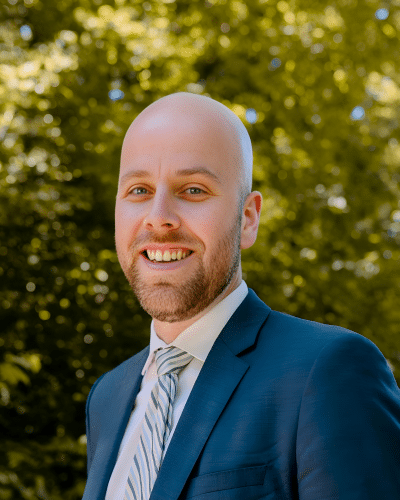
Project Hydrogeologist, WSP USA Solutions
Paul
Trudell
Experienced in managing environmental projects specializing in fractured bedrock hydrogeology in the Northeast.
Paul Trudell, P.Eng. is a Project Hydrogeologist at WSP USA Solutions, with 8 years of experience in the environmental consulting and engineering industry. He earned a BASc and MASc in Water Resources Engineering from the University of Guelph. From his hands-on field experience and technical roles on RCRA, CERCLA, and FUSRAP site investigation projects, Mr. Trudell has developed a specialization in fractured bedrock hydrogeology. Mr. Trudell is based in New York State where he works on projects throughout the northeast region, specializing in fractured rock hydrogeology and contaminant fate and transport.

